SPECIAL TRAVEL NOTICES
Sign Up for Tuolumne County Emergency Alerts delivered to your cellular phone and/or email while you're in the area.
---
Current Road Conditions
Updated: 2/23/26,9:00am.
This information is generally only updated Monday through Friday during normal business hours as needed. Check websites and call the numbers listed for the most current information.
Check nps.gov/yose or cal 209-372-0200 for the most current updates as conditions can change quickly with upcoming storms.
- Big Oak Flat Road (continuation of Hwy 120 toward Yosemite Valley from the west) OPEN!
- Tioga Pass (120 East) in Yosemite National Park: CLOSED FOR THE SEASON. Scheduled to reopen by Memorial Day Weekend 2026
- Hetch Hetchy Reservoir: TEMPORARILY CLOSED (Closes during snow or if snow is in the forecast)
Please protect wildlife by obeying speed limits.
Text "Yosemite" to 333111 to receive text (SMS) alerts about real time parking, traffic, and emergencies in Yosemite National Park.
Call CalTrans for current conditions at 1-800-427-7623 or view QuickMaps or Current Road Conditions. Conditions can change quickly with upcoming storms.
- Highway 108/Sonora Pass: CLOSED FOR THE SEASON AT SNO-PARK (11 MILES EAST OF STRAWBERRY) DUE TO SNOW.
- Caltrans encourages motorists to drive with caution, carry chains, and watch for icy road conditions in the early morning & evening hours. The route can close again due to inclement weather.


Quick Winter Travel Tips
Download Caltrans' Winter Driving Tips brochure for detailed information.
All drivers must carry tire chains or cables in their vehicle when entering a designated chain control area, even if the vehicle is equipped with 4-wheel OR all-wheel drive or is a rental vehicle, and may be required to install them.
Check the weather at the links below.
Before heading to the mountains for winter fun...
Winterize Your Vehicle: Check tires, battery, wiper blades, brakes, heater, fluids and lights
Pack an Emergency Supply Kit: First-Aid kit, food, water, flashlights, blankets, warm clothes
Carry tire chains, know how to install them, and check the road conditions at 1-800-427-7623
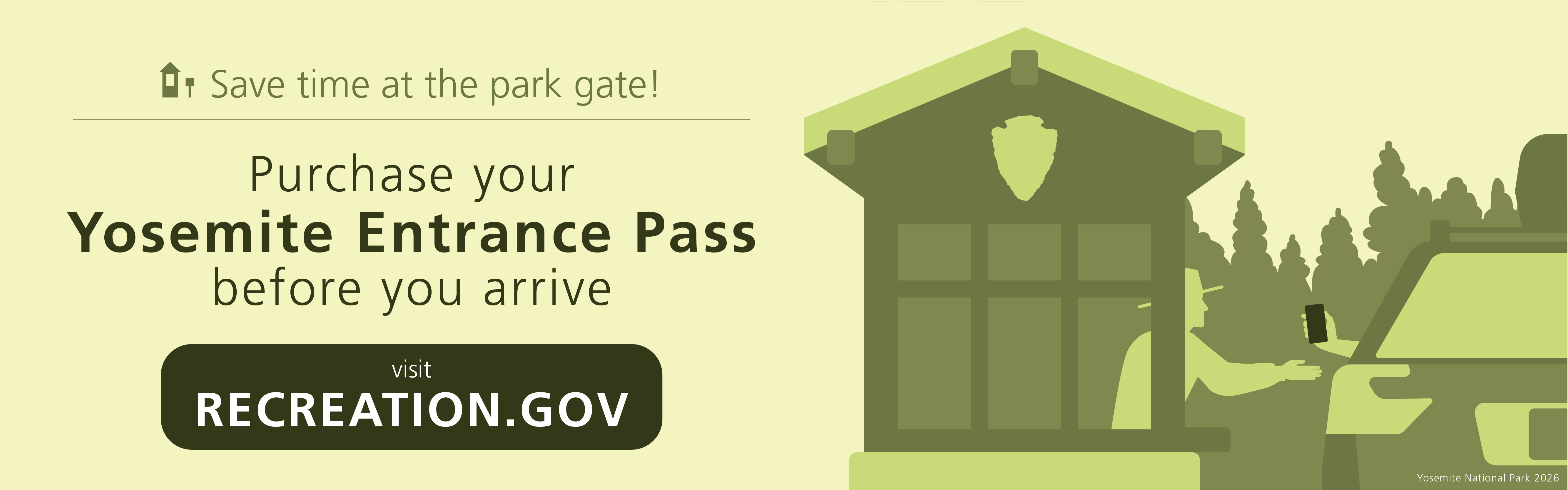
NO VEHICLE DAY-USE RESERVATIONS REQUIRED FOR 2026!
Day-use visitors to Yosemite National Park will not be required to make a reservation to enter the park in 2026. This provides added flexibility for travelers, while the park remains committed to managing traffic, protecting natural and cultural resources, and supporting safe, enjoyable visits for all.
Visitors traveling in 2026 are encouraged to plan ahead for a smooth Yosemite experience:
- Start your Yosemite adventure the easy way — purchase your digital entrance pass ahead of time.
- Travel midweek when possible--there are lighter crowds and easier parking.
- Start your day early, especially on weekends and holidays.
- Think beyond Yosemite Valley. The park has more incredible landscapes well beyond the most photographed spots. Check them out...download Beyond Yosemite Valley.
- Visit the park with a local guiding service or on public transportation like YARTS (Yosemite Area Regional Transportation System)
- Sign up for real-time park updates by texting “Yosemite” to 33311 to receive timely parking and traffic alerts as conditions change throughout the day.
- Check the park website for real-time conditions, seasonal updates and trip-planning tools.


Current Weather and Air Quality Conditions
Weather:
Click for pinpoint forecasts from the National Weather Service
Sonora | Groveland | Hetch Hetchy Reservoir | Twain Harte | Pinecrest | Yosemite Valley | Crane Flat on Big Oak Flat Rd.
Air Quality:
Click here to see the current air quality data while considering your outdoor activities.
View Local Webcams:
Note: These webcams are not operated by Visit Tuolumne County.
Groveland (Pine Mountain Lake Airport, off of Highway 120)
Groveland (CalTrans webcam, Highway 120; elevation 2,800 ft.)
Twain Harte (Highway 108 corridor; elevation 4,000 ft.)
Dodge Ridge Mountain Resort Webcams (Highway 108 corridor; elevation 8,200 ft. and 6,600 ft.)